
A CNM Quick Reference Guide
The following summaries provide you with a quick reference guide to important topics at Cabrillo. Refer to the Cabrillo Reference Manual (e-binder) for more in-depth information.
The Kumeyaay
Prehistory
When the Native Americans’ aboriginal ancestors crossed the Bering land bridge (now known as the melted Bering Strait) that connected Russia and Alaska about 15,000 years ago, they were searching for an environment that would allow them to maintain their hunting and gathering lifestyles. The abundance of marine and land resources in what is now known as California encouraged some groups to actualize permanent settlements, and soon the land was able to boast about 500 separate tribes and 90 different languages. Among these California peoples were the Kumeyaay, who inhabited what is now recognized as San Diego County and Imperial County some 12,000 years before European contact.
Masters of the Environment
The Kumeyaay were skilled at creating tools and other goods from their surroundings. At Cabrillo National Monument, we showcase a variety of plants used by these early Point Lomans for medicinal, dietary, hunting, cultural, and decorative items. The Kumeyaay were also skilled manipulators of their natural environment. They created water irrigation systems and regularly practiced burning the land (known as pyro-diversity) to improve the habitat of game animals, to create a healthy soil medium for the next season’s grasses and perennials, and to implement in-bulk harvesting techniques.
Life After European Settlement
Though the Kumeyaay and the European explorers practiced friendly trading, nonetheless these native people inevitably suffered a substantial population decrease with the introduction of measles and smallpox. Over the years, the Spanish mission system and the Mexican-American War and Civil War also severely diminished the numbers of Native Americans. However, the Kumeyaay have always been a resilient people and they fought relentlessly to win back their land rights. In 1875, U.S. President Ulysses S. Grant signed a Presidential Executive Order setting aside specific lands—known as the Sycuan Indian Reservation in Dehesa—in San Diego County for the exclusive use and residence of the Kumeyaay. Today, descendants of the Kumeyaay people still live in San Diego on 13 reservations.
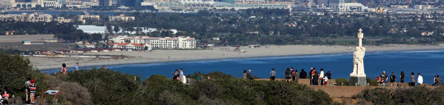
Juan Rodriguez Cabrillo
Early Life
Though there has been considerable uncertainty regarding where or when Juan Rodriguez Cabrillo was born, virtually all historians consider this explorer a Spaniard because he had sworn fealty to the Spanish crown, and everything he did was as a Spanish citizen. A conquistador in his youth, Cabrillo’s name appears in the ranks of those who served under the famous Hernan Cortes in battles against the Aztecs.
Exploring California
Cabrillo, our park’s namesake, led the first European expedition to explore what is now the west coast of the United States. He departed from Navidad, Mexico on June 27, 1542 in search of new trade routes between Central America and the Spice Islands off Asia. Three months later he sailed into “a very good enclosed port” known today as San Diego Bay. Historians believe he anchored his flagship, the San Salvador, on Point Loma’s eastern shore behind Ballast Point. He named this port “San Miguel” (a name that was changed to “San Diego” 60 years later by another explorer, Sebastian Vizcaino). His expedition continued north to Monterey Bay but came to a halt due to violent storms. On the journey back, Cabrillo and his crew settled in the Channel Islands for the winter. There, after a fall suffered during a brief skirmish with natives, Cabrillo shattered a limb and died of complications on January 3, 1543.
Legacy
Though Cabrillo’s contemporaries considered his expedition a failure, it left behind the first written glimpse of North America’s west coast. It also dispelled myths and misconceptions about the land. And, most important, his observations of weather patterns and currents led directly to the start of trans-Pacific trade, what we today call the “Pacific Rim”. Our Cabrillo National Monument, both in its name and its statue overlooking the bay, commemorates Juan Rodriguez Cabrillo’s voyage of discovery.
The San Salvador
The San Salvador was the first recorded European vessel to sail along Southern California, and the first to survey its coastline. Her expedition also established first contact with the area’s indigenous people. The San Salvador may be considered the founding ship of San Diego and California. She is an “origin symbol” ship for San Diego in much the same way the Mayflower is the origin symbol ship of New England. Her history represents the beginning of a common story for the people of California, both past and present.
The San Diego Maritime Museum, in partnership with Cabrillo National Monument, built a historically accurate, fully sailable replica of the San Salvador. Construction of the galleon took place on Spanish Landing and was based on meticulous research in the fields of Early Modern Spanish and Portuguese maritime history and maritime archaeology. The ship was officially introduced to the public on Sept. 4, 2015 as part of the Festival of Sail. This newest addition to the museum’s fleet is now located at the Maritime Museum docks.
The San Salvador is more than a static museum display. With San Diego as her home port, she sails along the coast of California, visiting cities and towns as a floating education platform for people of all ages.
The Lighthouses
The Old and New Point Loma Lighthouses
California had enjoyed statehood for just a year when the United States Coast Survey party traveled west in 1851 to determine the sites for the first eight west coast lighthouses. At 422 feet above sea level, the tip of Point Loma offered a perfect spot for a lighthouse because the light could be seen from the bay and the ocean. Construction for the historic lighthouse began in 1854 (which also signaled the construction of the first road along the ridge of Point Loma), and was put into service on November 15, 1855.
Though acclaimed as the highest lighthouse in the U.S., its elevation would ironically be its undoing; its light was often obscured by fog and low clouds. A new Point Loma Light Station was established at a lower elevation at Pelican Point in March 1891.
The old lighthouse was boarded up and abandoned. In 1913 the commanding officer at Fort Rosecrans recommended the lighthouse be torn down. But because of the magnificent view from the tower, the lighthouse was still quite popular with tourists. A major ‘life-saving’ historic rehabilitation of the lighthouse was undertaken between 1933-1935, when Cabrillo National Monument integrated with the National Park Service. In 1966, the lighthouse was restored and refurbished to reflect the lifestyle of a class of people who consistently demonstrated a sense of dedication and responsibility to what was truly a 24/7 job.
Military History
Fort Rosecrans
In 1848, when the treaty of Guadalupe Hidalgo ended the Mexican-American war, Ballast Point and all of Point Loma passed into the hands of the United States. In 1852, President Millard Fillmore set aside the Point Loma reservation for military use, though it remained a squatter haven and whaling community for another 18 years. During the Spanish-American War in 1898, the military reservation was named Fort Rosecrans after Civil War general and California politician William Starke Rosecrans. With its establishment as a military station, Point Loma remained the site of coast artillery gun batteries and observation lookouts for both world wars. Fort Rosecrans National Cemetery is located on the grounds of the former coastal artillery station. Although Fort Rosecrans is not an official part of Cabrillo National Monument, it is a vital part of the military history of the area.
The World Wars
During World Wars I and II, the construction of emplacements for Coast Defense Artillery and observation bunkers served as a protective ring around the harbor. Specifically during World War II, the monument was closed to the public and was not reopened to visitors until November 11, 1946. The military used the old lighthouse as a signal station. In World War II the lighthouse, like the rest of Point Loma, was under blackout restrictions. The soldiers placed black tar paper on all the windows if they wanted to turn on any lights. And the lighthouse, dwellings and sidewalks were painted an olive drab to make them less visible during the day. When World War II ended, Fort Rosecrans remained an active military post. However, the land surrounding the old Point Loma lighthouse was returned to the National Park Service, and the Navy was put in charge of all other facilities. Today, Fort Rosecrans National Cemetery serves as a namesake of the legacy of the coastal artillery station.
Point Loma’s Geology
Geologic History
About 70 million years ago, the area that would later become Point Loma would virtually be ocean waters about 3,500 feet deep. When this peninsula was beneath the water, it was at the end of a giant submarine canyon. You can think of it as the mouth of a river, where flowing sand traveled down the canyon in the shape of a fan and found its final resting place; each layer represents some underwater event that caused sand deposits. Over time, due to receding ocean levels and fault movement, the Point Loma peninsula was lifted out of the ocean and it continues to slowly rise today. It has lifted at an angle, so the west side of the peninsula is actually tilted up out of the water more than the east side.
Tidepools
Uneven erosion from wind, waves, and currents leave depressions in rocks that fill with seawater. Twice a day, low tides will usually expose these tidepools, which serve as homes and nurseries for many marine species.
Point Loma’s Climate
Climate Versus Weather
Our San Diego region boasts a moderate and subtropical climate, where the average annual temperature is 63 degrees Fahrenheit, and mean rainfall measures 10 inches. January is the coolest and rainiest month, while June, July, and August are the hottest and driest months. However, as predictable as the climate can be, San Diego’s weather is a bit of a different story. In fact, variability is an important facet of San Diego’s weather (and that of Point Loma). Therefore, it is important to check weather forecasts when planning visits.
Importance of Wildfire Prevention
The dry climate, frequent high winds, and fire-prone coastal sage scrub habitat make Cabrillo National Monument susceptible to wildfire. Whether started by a carelessly dropped cigarette, lightning, a spreading structural fire, or arson, a wild land fire has the potential to spread quickly and jeopardize public safety and park facilities.
Summertime Catalina Eddy
During the summer, the marine layer thickens at night and dissolves during the day. On occasion, this fog doesn’t disappear during the daytime, and this can be attributed to the Catalina Eddy—an upper-level airflow that travels from the Catalina Islands and thickens and spreads clouds and fog by the time it reaches inland San Diego.
Rocky Intertidal Area
Tidepool Zonation and Creatures
Tidepools provide a home for many animals. They are created by the changing water level, or tides. The high-energy waves make this a harsh habitat, but the animals living here have adapted over time. When the earth, sun and moon align during the full and new moon we have extreme high and low tides. Generally, there are two high tides and two low tides a day. Most often the Cabrillo intertidal zone is accessible during a low-low tide from October to May (during park hours).
There are three zones within the tidepools: the high zone, the middle zone, and the low zone. The process of evolution has determined where the animals can live and thrive. The tidepools at Cabrillo are protected and have been monitored by the National Park Service since 1990. You may notice bolts in the rocky intertidal; these are used to assist scientists in gathering data to monitor changes.
High Zone: The high zone is covered by the highest tides. Often this area is only sprayed by the crashing waves. The animals that live here must endure a long time without water as well as high wave energy and human disturbance.
Middle Zone: The middle zone is covered by the highest tides and exposed by the lowest tides. The animals here are adapted to live in and out of water.
Low Zone: The low zone is only uncovered by the lowest tides. Animals here are submerged in water most of the time. Some of the animals in this zone like to hide under surfgrass because it provides shelter and refuge against higher rates of predation.
CNM Tidepool Management Zones
CNM created tidepool boundary areas around the tip of the Point Loma Peninsula into:
- Zone 1 – directly at the end of the tidepool path from Parking Lot 1; most visited, most area uncovered at higher tides
- Zone 2 – starts approximately at south end of Zone 1 bay and ends at the Coast Guard boundary; only uncovered during low tides
- Zone 3: closed to public; extends around entire tip of peninsula; used as a control area for research; one of the TPERP’s (Tidepool Protection, Education and Research Program) prime missions is to protect Zone 3

Commonly observed tidepool life
Mussels, Barnacles, Owl Limpet, Key Hole Limpet, Chiton, Shore Crab, Hermit Crab, Kelp Crab, Tegula Snail, Sea Urchin, Knobby Sea Star, Anemones, Octopus, Brittle Star, Moray Eel, Sea Hare, Nudibranchs, Sea Grass, Kelp, Feather Boa Kelp, Sea Lettuce, Sculpin, Garibaldi, Opal Eye
Coastal Sage Scrub and Chaparral
The power of sunlight plays a huge role in the plant communities here at Cabrillo National Monument. The park can be divided into two main plant communities. The first community, called Coastal Sage Scrub, is populated by small plants that only grow to a height of 3 feet. The plants tend to be spread out and brown dirt is often seen in these areas. This community is usually found on southern facing slopes. Here the sun shines directly on everything for most of the day.
Chaparral, the second community, is categorized by woody shrubs that can grow to 8 feet. These shrubs grow close together with little bare ground between plants. This community is usually found on northern facing slopes where the sun does not shine directly and there is more shade. As you look around the park try to notice the differences. Where the plants are tall and it would be close to impossible to walk through them, this is the Chaparral.
The Coastal Sage Scrub is our most sensitive habitat. The plants here are fighting to stay alive and you can help them most by staying on the paths and letting these special plants have a chance of survival. Once the predominant vegetation of the San Diego coast, this ecosystem has now shrunk to remnants of its former size due to development and introduction of non-native plants. The park preserves a remaining oasis of this ecosystem, one of the most sensitive in the world.
Commonly observed terrestrial vegetation
Snake cholla, prickly pear cactus, Mojave yucca, Shaw’s agave, California coast poppy, Indian paintbrush, California buckwheat, California sagebrush, and lemonadeberry
Snakes and Amphibians at Cabrillo
Cabrillo National Monument is home to 12 species of herptiles – six species of snakes, five species of lizards, and one amphibian, the garden slender salamander.
Long-term monitoring of these species began in 1995 by Dr. Robert Fisher (SDSU, then USGS), as part of a larger scale study of herptile species in Southern California. NPS took over monitoring at Cabrillo National Monument in 2002 to continue assessments of possible decline in species’ numbers. Because the Point Loma peninsula is island-like (surrounded on three sides by ocean, and to the north, cut off by development), and due to their limited home ranges, these animals are extremely susceptible to population decline and extirpation (no longer existing in a particular area where they historically were found). In fact, eight reptile species have already been extirpated from the peninsula: Coronado island skink, red diamond rattlesnake, yellow-bellied racer, coast horned lizard, red coachwhip, two-striped gartersnake, California glossy snake, and the Western long-nosed snake.
Commonly observed terrestrial vertebrates
Western fence lizard, Side blotched lizard, Southern Pacific rattlesnake **(our only venomous species. If you are lucky enough to see one, please give it some room, take a photograph, and report the location to a ranger), Desert cottontail, California ground squirrel, Orange-throated whiptail lizard, Striped racer, San Diego gopher snake, San Diego alligator lizard, California kingsnake
Birds at Cabrillo
Point Loma and Cabrillo National Monument are well known in the birding community as premiere bird watching spots in San Diego. The bird checklist for both the monument and Point Loma peninsula lists 346 species, with over 200 spotted at Cabrillo National Monument alone.
A stop on the Pacific Flyway, migrant species use the peninsula as a resting place or when lost or disoriented. Raptors use Point Loma as a landmark during the peak of their migrations, and some, like the red-tail hawk, make their home here year-round. The rocky shoreline on Point Loma’s western side is the only place in San Diego where black oystercatchers are regulars, and Brant’s cormorants roost in large numbers on Point Loma’s cliffs.
Commonly observed birds (year-round residents)
California quail, California thrasher, California brown pelican, Western gull, Snowy egret, California towhee, Peregrine falcon, Spotted towhee, Anna’s hummingbird, Osprey
Marine Mammals, Featuring the Pacific Gray Whales
An assortment of marine mammals such as dolphins and pinnipeds (seals and sea lions) can be seen from the cliffs of Cabrillo National Monument. The occasional seal or sea lion might even be caught sunbathing on a rock ledge or looking for food around the shallow tidepools. Respect these wild animals by maintaining a cautious distance and never approach them. All marine mammals are protected under Federal law.
By far the largest mammals in the Point Loma area are the Pacific gray whales, which pass by on epic annual migrations between December and March. At 45 feet long and 33 tons, these impressive marine mammals spend summers feeding in the cool, northern waters of the Chukchi and Bering seas. In early autumn, gray whales head south along the west coast for Mexico, a 5,000-mile trip one way, the longest migration of any mammal on earth.
For 40 to 60 years, a gray whale will continue this pattern. This predictability made them easy targets for hunters, who harvested the animals nearly to extinction in the 19th century. Gray whales have been protected from exploitation by the International Whaling Commission since 1946.
The Relationships Between People and Their Environment
As a volunteer at Cabrillo National Monument, you will have many opportunities to help protect and interpret the unique elements of the park. From the world-class views to the cultural and natural resources, you can help visitors understand the unique and intimate relationship we have with our environment.
Last revised 31-Dec-25
