
Geology of Cabrillo National Monument
This article is from Pages of Stone: Geology of Western National Parks and Monuments by Halka Chronic and is now out of print, but not out of date.
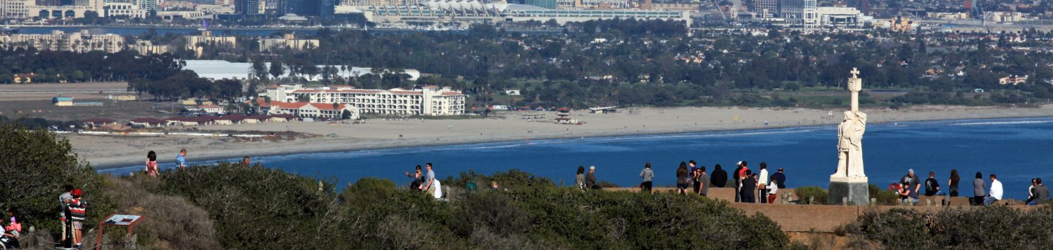
At the very tip of Point Loma, Cabrillo National Monument commemorates explorer Juan Rodriquez Cabrillo, who sailed into San Diego Bay in 1542. In addition to its historical attraction, the area offers a glimpse of prehistory in the geologic features of Point Loma, as well as in views of San Diego and San Diego Bay.
Point Loma itself, a slender fault block lifted high above neighboring fault blocks, is made up of marine sandstone, shale, and conglomerate. These sedimentary rocks are found elsewhere as scattered remnants along the southern California coast. They were deposited in Cretaceous time in shallow sea waters just west of the westward-drifting continent. Some of them, recognized by grading of individual beds from coarse-grained to fine-grained, are turbidity deposits, sand and mud released rapidly by submarine landslides near the edge of the continental shelf.
 The high, irregular ridge of Point Loma, with its east-dipping strata, is the east limb of an anticline that also dates back to the Cretaceous time. The western side of the anticline is thought to lie six kilometers (four miles) out to sea. The Point Loma ridge shelters the northern end of San Diego Bay from prevailing west and northwest wind and waves, and establishes the counterclockwise circulation of nearshore waters that is responsible for the protected bay, the largest natural harbor south of San Francisco.
The circulating water picks up sand at the mouth of the Tijuana River, just north of the Mexican border, and carries it northward, depositing it as a long sand spit – the Silver Strand – that connects the town of Coronado and North Island to the mainland and defines San Diego Bay.
Like other streams flowing to the sea in this region, the Tijuana River has now been dammed. Much of the sand that would normally reach the sea remains trapped in reservoirs behind the dams. As a result, sand lost during winter storms is not fully replaced by summer currents, and beaches and sandpits along the coast are becoming narrower. The dams also prevent enlargement of the harbor’s protective spit, which eventually, if left in its natural state, might connect with Point Loma, sealing off the harbor. Problems of dredging the bay and maintaining the channel should in theory be helped by the damming of the river.
The city of San Diego and most of its suburbs lie on a series of old wave-cut marine terraces that slope gently toward the Pacific. Three terrace levels are recognized in this area: the La Jolla Terrace roughly 20 meters (60 feet) above sea level, well developed near Mission Bay north of Point Loma; the Linda Vista Terrace between 100 and 150 meters (300-500 feet) above sea level, on which most of metropolitan San Diego is located; and the Poway Terrace some 250 to 350 meters (800 to 1200 feet) in elevation.
Marine terraces are sea-cut platforms later raised above sea level. Initially they formed at wave base, a few feet below the actual surface of the sea, where wave erosion is most effective. Terraces here and elsewhere along the California coast are now above sea level because of uplift along faults. Faults also offset different parts of each terrace. Most of the faults parallel the coastline. Easily visible from Point Loma, a recently active fault runs along the northern part of the city, connecting the center of the city through Rose Canyon to the coast north of La Jolla.
Much of the fault movement in this area, as well as in the rest of coastal California, is horizontal rather than vertical. The horizontal movement parallels the coast, as seaward segments move north relative to landward segments. This is the same type of horizontal offset that occurs along the famous San Andreas Fault, far inland east of San Diego. Onshore faults have been recognized for some time; offshore faults, only recently discovered, create an unusual continental border of submarine ridges, shallow submarine platforms, and long, deep basins paralleling the coast. This rugged, mountainous border, hidden of course from the eyes of man, extends out about 250 kilometers (150 miles) from shore.
Also hidden beneath the sparkling Pacific is the La Jolla submarine canyon, at right angles to the coast. It cuts through the offshore ridges and platforms west of La Jolla. One of several such undersea canyons along the California coast, it is the work of a sand- and mud-laden longshore current coming from the northwest, turned aside by the La Jolla headland. Dense and heavy with its sediment load, the current flows like a river down the continental slope, scouring and irregular, ever-deepening channel. It ultimately drops its sand and silt on a submarine fan at the canyon’s mouth, about 40 kilometers (25 miles) offshore, where the water is around 1000 meters (3300 feet) deep.
Geologic History
The story of the San Diego area begins in Jurassic time with intrusion of the granite that makes up the core of the Peninsular Ranges east of San Diego. The granite is of the same age and origin as some parks of the Sierra Nevada’s Batholith. In Cretaceous time, sandstone, shale, and conglomerate – the rocks now exposed on Point Loma – were deposited in shallow seas that bordered the continent. Along with these marine sediments are some volcanic rocks, relics of long-gone volcanoes erupting along the subduction zone where the Pacific Plate dives beneath the edge of the continent. The south-westward movement of this part of the continent in late Cretaceous and early Tertiary time caused a certain amount of warping and benching, and is responsible for the broad anticline of which Point Loma is the eastern part.
In Tertiary time the continent – the North American plate – continued its south-westward drift and its overriding of the East Pacific Plate, and more sedimentary and volcanic rocks were deposited along the coast. Uplift and west-ward tilting elevated the Peninsular Ranges, and vertical and horizontal movement along many faults gradually brought the coastal area close to its present configuration.
Periodic earthquakes in this area show that movement along the faults goes on today. Historical records indicate that there has not been a really severe earthquake – of magnitude greater than 4.0 on the Richter scale – in historic time. In 1964, though, three sharp tremors of magnitude 3.7, 3.6, and 3.5 resulted from sudden movement along the part of the Rose Canyon Fault that extends south beneath San Diego Bay.
The sea is responsible, as we have seen, for the final shaping of the coast, as rivers and streams are for details of mainland geography. With periodic uplift and, in Pleistocene time, drops in sea level as great ice sheets farther north tied up sizeable volumes of water, the pounding waves carved a series of nearly level terraces, each of them partly cut away as the next one formed. South of Point Loma, a counterclockwise current became established, gradually to build up the sandspit that now shelters San Diego Bay.
Along the seaward side of the Point Loma headland, another marine platform is now being shaped by the sea. Able to penetrate the wave-dampening effects of thick offshore kelp “forests”, Pacific storm waves still strike with force, hollowing out channels, caves, tunnels, and tidepools in Cretaceous rocks of the headland. As the steep bluffs are undermined, they collapse. Piles of landslide rubble are eventually swept away by the sea. Broken into sand grains and rounded pebbles, they will be carried along the shore and deposited as beaches or sandspits. Or they may become part of the turbidity currents that flow down submarine canyons, in which case they will come to rest in the submarine fans far from shore.
From Pages of Stone: Geology of Western National Parks and Monuments by Halka Chronic (out of print)
Last revised 26-Nov-19
